Comprehensive Service
We offer detailed design, conversion and set-out services that are conducted in three separate phases.

We offer detailed design, conversion and set-out services that are conducted in three separate phases.

Our in-depth and extensive knowledge of the kiwifruit industry allow us to customise your plans and data in order for you to make important orchard development decisions.

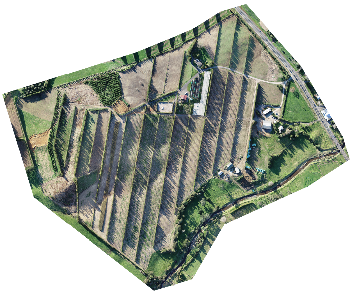
We use the latest aerial imagery and geo-spatial technology to ensure orchard data is captured with the highest degree of accuracy possible.
The first step of the project is to schedule your job with one of our orchard design specialists.
Onsite we use a drone to capture high accuracy imagery of your greenfield site. Our drones use GPS along with ground-based correction signals, enabling us to fly and map with sub-5 cm accuracy.
Your initial map will include:
Accurate size of the greenfield site
Digital surface model of the site
Optional:
Soil data

After the initial site survey, we'll talk with you through any ideas you have for the design. We'll also gather key design details—like bay sizes, headlands, and other requirements. From there, we’ll create a custom design plan that reflects your vision and helps you get the most out of your site.
The design plan will include:
Structural components of the block; rows, Ag-Beam, end assemblies, and internal posts
Natural and artificial shelter
Block outlines including areas
Total plantable area
Infrastructure quantity report
Optional:
Planting layout
Male and female planting plan
Additional features unique to your site
We’ll continue to make revisions of the design until you’re fully satisfied. Once it’s finalized, you’ll receive the final version along with a report detailing infrastructure quantities.
With established quantities of equipment you can source quotes and estimated costs for your orchard set up.
The development plan can be provided to your bank as part of your orchard financing proposal.
The map can be used as part of your tender for licensing. GPSit is Zespri’s preferred mapping supplier and auditor.

Using the finalized orchard design, we use GPS units to accurately mark out the following with flags. We can mark out as many or as few as you require:
End assemblies
Outside posts
Internal posts
As a result your contractors will immediately understand the exact locations for your infrastructure and planting plan.

“We outsourced our orchard design to our trusted partners at GPSit who maximised productive space and ensured layout was designed to suit our growing conditions. The whole process was facilitated by skilled field technicians who offered expertise right through; from block and plant layout to precision marking out onsite. We couldn't have been happier with the outcome, saving us time and energy allowing us to focus on installation."