WE MAP ALL INDUSTRIES
We map all types of horticulture properties including kiwifruit, apples, avocados, citrus, berry and other types of orchards.
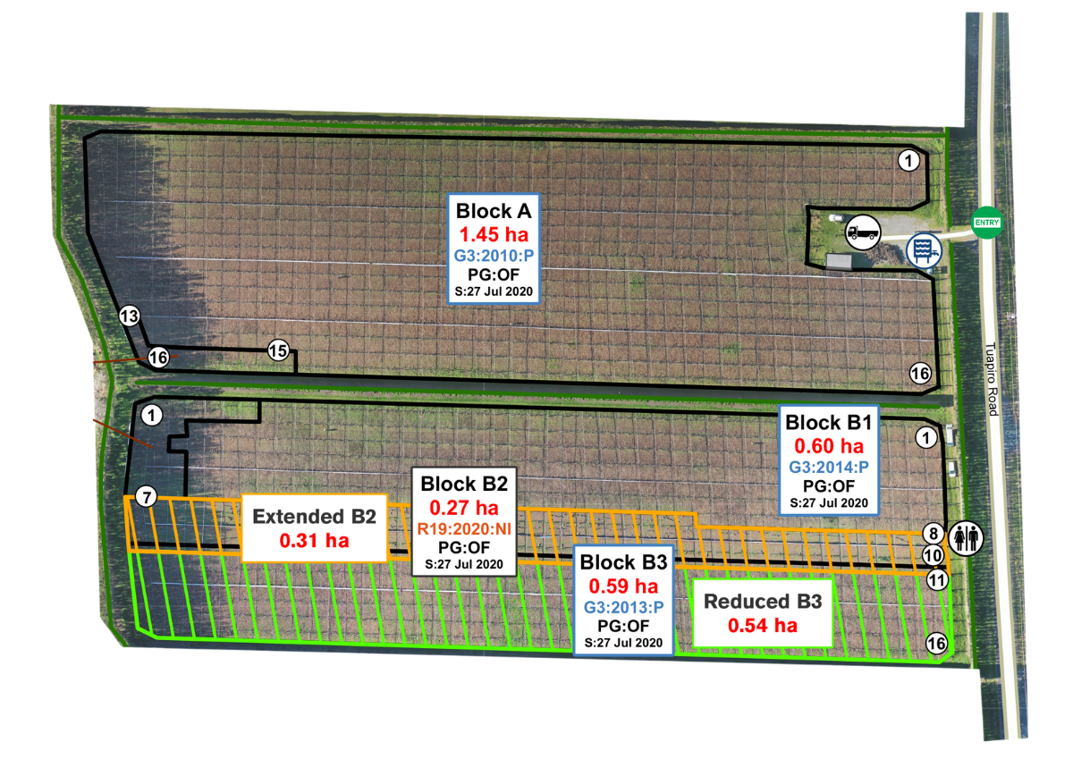
.png?width=1264&height=800&name=Matts%20Orchard%20Outline%20(4).png)

We map all types of horticulture properties including kiwifruit, apples, avocados, citrus, berry and other types of orchards.

We map orchards using the latest available technology. The survey grade RTK (real time kinematics), GPS units and drones provide high-resolution imagery with detail like no other.
Our in-depth knowledge about orchards and surveying allow us to generate precise maps to help you make important decisions about your orchard with confidence.
We customise our maps to tailor to your particular requirements. Please note that some features may incur an additional cost due to additional drafting time.
As different things are important to different landowners, we customise our maps to fit your needs.
Some features may incur an additional cost.
![]() Block size, name and structure type
Block size, name and structure type
![]() Total mapped area and variety totals
Total mapped area and variety totals
![]() Number of rows
Number of rows
![]() Buildings and structures
Buildings and structures
![]() Chemical sheds
Chemical sheds
![]() Shelter belts
Shelter belts
![]() Roads and orchard entry points
Roads and orchard entry points
![]() Loading areas
Loading areas
![]() Plant counts
Plant counts
![]() Underground water pipes
Underground water pipes
![]() Irrigation systems
Irrigation systems
![]() Slope analysis
Slope analysis
![]() Contours
Contours
![]() Soil drainage and type
Soil drainage and type
![]() Site hazards
Site hazards
![]() Prevailing wind
Prevailing wind

SITE VISIT
Once you have accepted your quote our experienced team will get in touch to arrange a survey of your orchard.
.png)
DRAFTING
Once the survey has been completed our GIS technicians can begin drafting your orchard map.
.png)
QUALITY ASSURANCE AND REVISIONS
Before finalising your map we will get in touch to review your specifications and features plus revise any changes that may be required.
.png)
FINAL MAPS AND PRINT PRODUCTS
We will supply you with your map. Pre-ordered printed products will be generated and shipped to you.
Your orchard map can be printed on a variety of products, including A3/A4 pads, whiteboards in numerous sizes or PVC banners. These products are ideal for the office or out in the orchard. They are invaluable tools for workers, contractors and visitors to your property.
We specialise in the kiwifruit industry. Here are our other services.
We developed the cultivar licencing audit programme for Zespri® in 1999 and have carried out the audit programme ever since.
By using high-grade survey equipment and the latest drone (UAV) technology we ensure orchard data is captured with the highest degree of accuracy.
For more information visit our Zespri Audit FAQ's page.

A canopy estimation map may be useful for:
![]() License application or tender
License application or tender![]() Grafting a licensed variety
Grafting a licensed variety![]() Before splitting or merging structures
Before splitting or merging structures![]() Removing canopy in a title dispute or re-allocation
Removing canopy in a title dispute or re-allocation
If we have surveyed your orchard in the last three years and you have made no changes GPSit can use the imagery from our records to create a canopy area estimation map for you. Contact us for a quote.
However, if you have made changes to the orchard since your last survey or you haven't had your orchard mapped with GPSit previously then we will need to conduct a survey onsite. Please fill out our survey quote form here.


"The team at GPSit have mapped many of our managed orchards. They always try to accommodate us to our ever changing needs and always ensure that they deliver a final product that we are satisfied with."